Lambeth Horticultural Society
Upcoming Meetings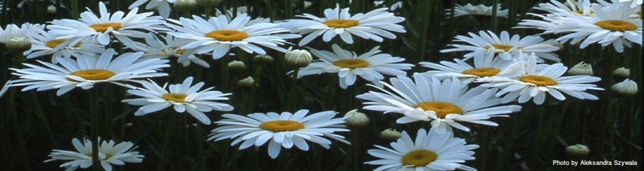
Welcome!We are so glad to see you popped by to visit the Lambeth Horticultural Society website. Please feel free to browse our website. If you have any questions, please contact us! inquire@lambethhort.com What to see and do in the community of Lovely Lambeth
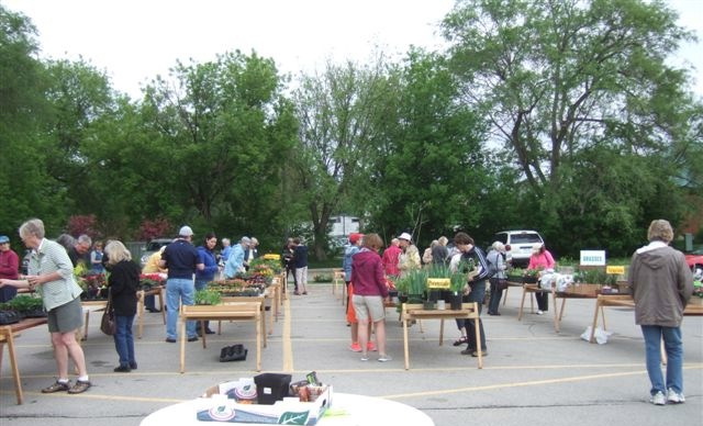
Upcoming MeetingsMeetings are held the 3rd Monday of the month, 7:30 pm (dates may change due to holiday weekends – see list below) at the Lambeth United Church located on the corner of Colonel Talbot Road and Main Street in Lambeth. http://www.lambethunitedchurch.caMay 13, 2024 – 7:30 pmJune 17, 2024 – 7:30 pmJuly – too busy in our gardens for a meetingAugust – too busy enjoying our gardens for a meetingSeptember 16, 2024 – 7:30 pmOctober 21, 2024 – 7:30 pm
Speakers and Designs
May 13, 2024 Terri DentTerri is from the Chatham area and has a vast knowledge of gardening that she has shared with many horticultural societies and Master Gardener groups.Her topic for this evening is Eco Gardening and Focusing on the Goodness of Gardening – The Do’s and Don’ts. She finds this topic one of her favourites and is looking to the new friendships she will make at our meeting!The Design Theme for this meeting – ‘Thunder and Lightning – A Vertical Design’Premiums will be given to current (2024) members of the Lambeth Horticultural Society at this meeting. Please make sure you bring your membership cards.
June 17, 2024 Mini Flower ShowFresh Flowers, Your Favourite Vase = A Beautiful Centrepiece For you!We will be asking you to bring in some fresh flowers, from your garden or store-bought, and your Favourite Vase. At this meeting we will have “Flower Arrangers” to help arrange and create a stunning bouquet of flowers for your own home!!Our Previous Speakers this year:April 15, 2024 Scott MacDougall-ShackletonScott has been a professor at Western University since 2002. He serves as the Director of the Advanced Faculty for Avian Research, a globally unique bird research facility at Western. He has published almost 150 research articles and book chapters on topics including bird song, bird reproduction, bird migration, and seasonal changes in birds. At our meeting he will be discussing the topic of Birds and the Weather.The Design Theme for this meeting – ‘A Spring Water Viewing” designMarch 18, 2024
|
|
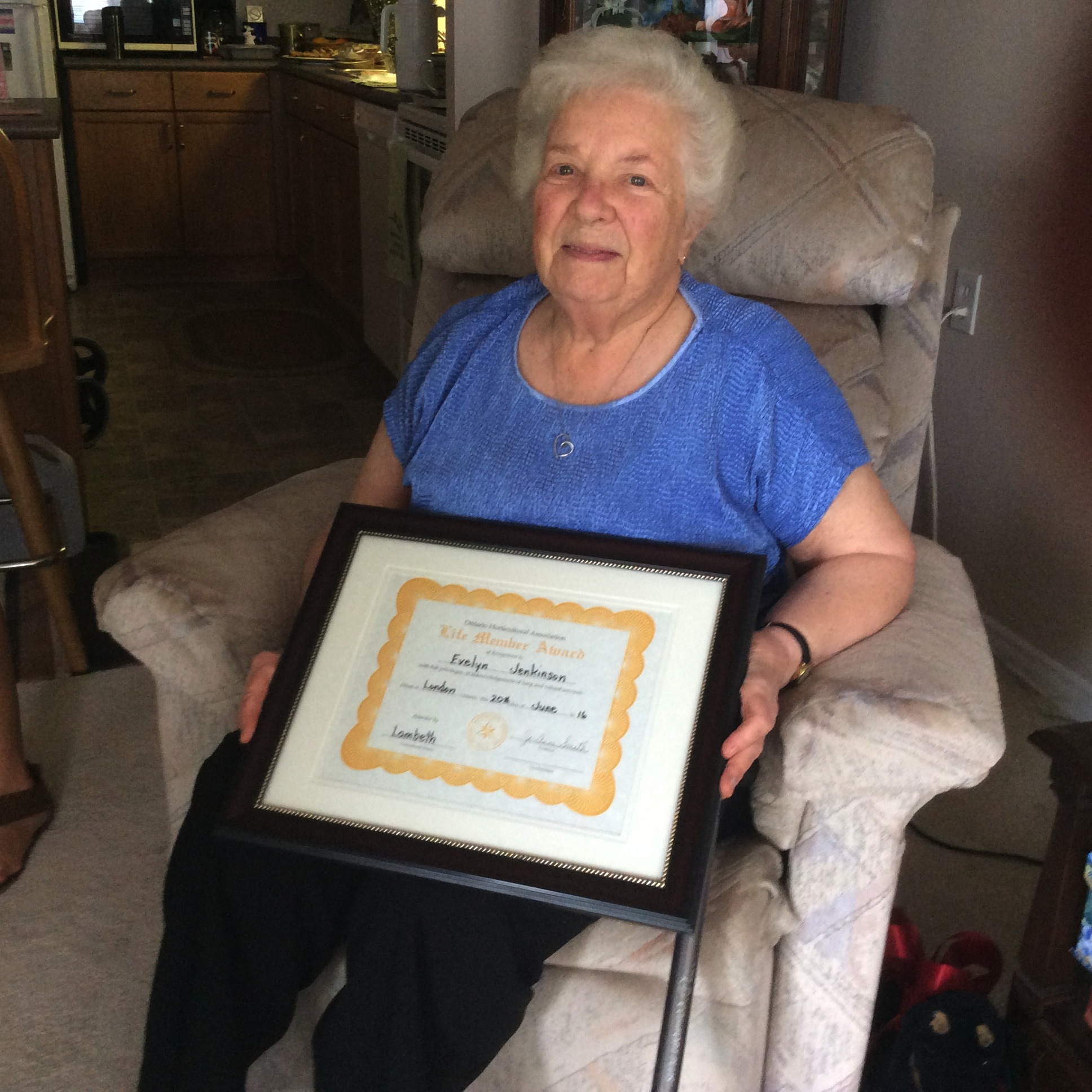
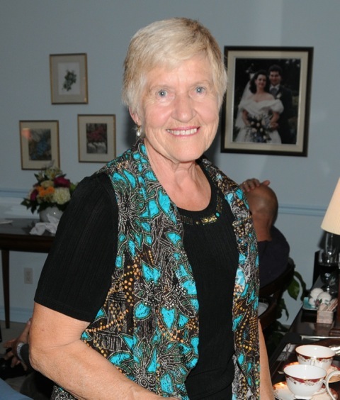
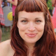
Evelyn Jenkinson
|
Ruth Dodson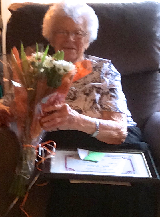 |
Speakers – Past Meetings
 |
May 15, 2017
Design: “The Beauty of Spring” – a small design |

|
April 17, 2017 Design: “Easter Parade” – a parallel design Speaker: Trish Symons – A passionate, enthusiastic and energetic gardener who spoke at the Lambeth Horticultural Society meeting back in October 2012. Our bus trip in June 2016 visited her home and gardens in the Shelburne area. Topic: “There’s a Puppy in my Garden” |
|
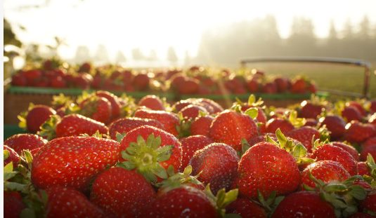
Monday, March 20, 2017 Speaker: Will Heeman – Heemans Garden Centre & Strawberry Farm “Strawberries and the History of the farm”. Design: “Spring Board” – an interpretive Design |
| Monday, February 20, 2017 Speaker: Julian Bayley – Ice Culture, “The growth of Ice Culture and the making of their sculptures”. Design: “Picture Perfect” – 4 x 6 photo of a Focal Point in your 2016 garden. |
|
 |
Monday, January 16, 2017 Speaker: Brenda Gallagher (Forestry Technician – Vegetation, Upper Thames Conservation Authority. “Trees in Ontario”. Design: Winter Solstice – a design incorporating winter greenery and 1 white flower. |
 |
Monday, October 17, 2016 Speaker: Roland Craig “A tour of the Harrogate Flower Show in North Yorkshire, U.K. Design: “Natures Image” – A design using wood and/or rock |
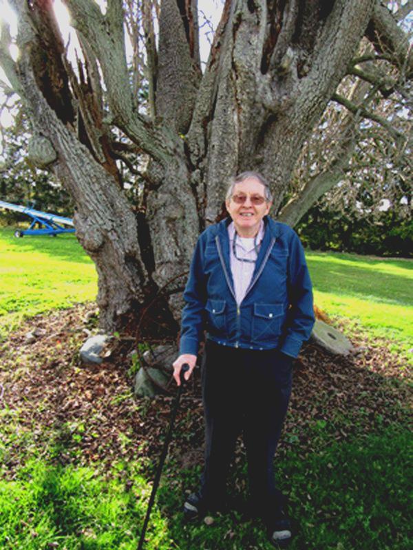 |
Monday, September 19, 2016 Design: “Fall Festival” – A modern design. Speaker: Robert Holland “Saving the Jesuit Pear Tree” http://www.jesuitpear.com/Earl ller standing in front of his ancient Jesuit Pear Tree |
 |
Monday, June 20, 2016 Design Class: “It’s Summer” – an interpretive design Speaker: DAVID BILYEA is a graduate of Ridgetown College and now is employed there as a weed science technician involved with weed control studies. Topic: “Viny weeds of Ontario” |
 |
Monday, May 16, 2016 Speaker: MARION JARVIE is a passionate gardener and has been gardening in Thornhill for 40 years. She has been involved with both the Toronto and International gardening communities. Marion is an accomplished photographer and enthusiastic educator. She teaches regularly at the Toronto Botanical Garden and has lectured all over North America and in the U.K. Topic: Gardening Highlights |
 |
Monday, April 18, 2016 Speaker: ROB LEBROW from Sedum Master, a company 9 years young, grows 120 different varieties of sedum that they use to create sedum blankets and panels, green roofs, living walls and other projects. Topic: Sedum |
 |
Monday, March 21, 2016:
Speaker: DAVID SHERRY |
 |
Monday, February 15, 2016: Design: “Mini Garden Tour” Bring 3, 5×7 photos showing highlights of your 2015 garden Speaker: DENISE HODGINSOntario Diploma in Horticulture and writes for the London Free Press Topic: The Monthly Garden To-Do List Click here for a full review>DeniseHodginsFeb2016 |
 |
Monday, January 18, 2016: Speaker: BECKY ELLIS Coordinator of Sprouts Children’s Garden Program (focusing on urban agriculture) Topic: GARDENING WITH WILDLIFE” Click here for a full review> BeckyEllisJan2016 |
January 15, 2018:
Note: please bring any used or unwanted pairs of socks to the meeting to be donated to the Salvation Army.
Come join us for a meeting that will offer you something new and different!
Defy those winter chills and feel the warmth as we sit at tables and taste test various coffees and teas while learning about their origin and history.
Speakers: Fire Roasted Coffee Co. https://fireroastedcoffee.com/pages/visit-a-cafe and The Tea Lounge http://www.beteas.com/tea-lounge/
September 18, 2017
Speaker: Kevin Kavanagh, owner of South Coast Gardens, a small specialty nursery and landscape design business located along the north shore of Lake Erie’s ‘Carolinian zone’.
Topic: Magnolias, Rhodos, and Azaleas
Design: “Birthday Bash” – a red and white design to include vegetables.
June 18, 2018
Speaker: Shelley MacKenzie
(St. Thomas Horticultural Society)
Topic: “Elevated Park and Walkway with a Stumpery Garden”
Design Class: “June Bugs” a small design
October 16, 2017
Speaker: Suzanne Steed of Steed and Company Lavender
Topic: All things Lavender (growing, benefits and uses of lavender).
Design: Autumn Joy – a design to include wood
January 21, 2019
Speaker: Andrew Barber
Andrew is an organic farmer who has taken an interest in Buckfast bees.
He currently has ten hives on his property and is interested in different hive styles. Our meeting will be Cafe style. Coffee and tea will be served with honey samples. Design Class: No design class, but please bring a photo of your favourite part of your 2018 Garden to share with your fellow members. Photo’s will not be judged.
February 18, 2019
It’s MOVIE NIGHT!
We will see the movie “Highgrove House”, one of England’s most important contemporary gardens. Meet the best Royal Gardener in history – Prince Charles. “Theatre” snacks will be provided.
Design Class: Interpretive with a single red rose.
March 18, 2019
Speaker: Dave Bilyea from the University of Guelph (Ridgetown Campus)Topic: “Spring Tune Up and Lawn Care” – general tips for maintaining a healthy lawn, problems that can occur and why they happen.
Design Class: Emerald and Aquamarine – A Satellite Design
SEPTEMBER 16, 2019
Mini Flower & Vegetable Show: View Schedule here> Mini FlowerSep2019
SPEAKER: Margaret Dudley (President of the Belle River Hort Society and knowledgeable speaker). TOPIC: Bulbs for All Seasons
DESIGN: “Summer Twilight” – a modern mass design
NOVEMBER 18, 2019
ANNUAL GENERAL MEETING AND POTLUCK
MEET AND GREET 5:30 – 6:30 pm DINNER at 6:30 pm
LIGHT ENTERTAINMENT: Country Versatiles
Sprigs of greenery will be available for all to create a festive design/arrangement to adorn your home for the Christmas season.
Bring your container (or a small tuna/salmon can) and have fun creating! If you have extra ribbon or decorative items to share with other members, please bring them.
JANUARY 20, 2020
SPEAKER: ‘Full of Beans’ Kim Dietrich – will talk about her business, how it started and the new family life style change with beans in it. This change also gave her an opportunity to promote beans and share their products with consumers.Our meeting will be set up cafe style. DESIGN: Fragrant Memories – Small Dried Arrangement
JANUARY 18, 2021 – MEETING VIA ZOOM
SPEAKER: Darren Heimbecker TOPIC: Whistling Gardens. Daren will walk with us through the bright sun filled colourful gardens in the middle of winter and share with us the updates, the new plants and the future for Whistling Gardens. DESIGN: “Storms and Blizzards” an inerpretive design. PLEASE CONTACT HELEN PETERNEL if you wish to show your creation during the meeting. No judging.
FEBRUARY 15, 2021 – MEETING VIA ZOOM
SPEAKER: Dr. Youbin Zheng
TOPIC: Learning about Cannabis. Dr. Zheng works at the University of Guelph and one of his current research projects is on Indoor Medical Cannabis Production. An interesting complex topic indeed!
DESIGN: “Lasting Treasures” – a small design (use the flowers that you dried last fall). PLEASE CONTACT HELEN PETERNEL if you wish to show your creation during the meeting. No judging.
MARCH 15, 2021 – MEETING VIA ZOOM
SPEAKER: Dr. Jeremy McNeilTOPIC: TBA. Dr. McNeil is a distinguished professor at UWO and has spoken to us several times before. He is an extremely knowledgeable man who brings interest and entertainment to his every presentation.
DESIGN: “TOP O’THE MORNING” – an all green design.
PLEASE CONTACT HELEN PETERNEL is you wish to show your creation during the meeting. No judging.
APRIL 19, 2021 – MEETING VIA ZOOM
SPEAKER: Robin Pero – owner of Grow & Bloom
TOPIC: HOUSE PLANTS: Growing trends and growing house plants for our well being.
Design Idea – “Spring Has Almost Sprung” – A Parallel Design
MAY 17, 2021 – MEETING VIA ZOOM
SPEAKER: DR. ANDREW PEREGRINE
TOPIC: “Tick and Lyme Disease”. Dr. Peregrine is a veterinarian and clinical parasitologist at
the University of Guelph. How to identify the tick responsible for Lyme disease and
how to reduce the risk of infection in both dogs and people.
Design Idea – “Refreshing” – a Water viewing Design.
JUNE 21, 2021 – 7:30 pm – MEETING VIA ZOOM
SPEAKER: David T. Chapman – The Storm Chaser
TOPIC: Wild, Weird and Wacky Weather
Next Zoom Meeting: MONDAY JANUARY 17, 2022 at 7:30 pm
Speaker: Ben Porchuk Topic: Bringing Forests Home
If you recognize Ben’s name, you have a great memory! He spoke to us May 2012.
Ben is a modern example of how one can take the simple step of bringing nature back to our yards, while turning the tables on climate change and
the continued loss of plant and animal species. This talk will be sure to help you “Bring the Froest to Your Home.”
Zoom Meeting: MONDAY FEBRUARY 21, 2022 AT 7:30 pm
Speaker: Anna Leggatt Topic: Around the World in 40 plants.
Anna is a Toronto Master Gardener, past chair of the Ontario Rock Garden Society, Past Dir. of the N.A. Rock Garden Society and a nenber of the East York Garden Club.
She is basically a mad gardener, gardening in a large shade garden in Toronto with visiting mink, deer, rabbits, and groundhogs.
She loves rock gardens, wildflowers, working with stone. She wants to grow vegetables. However, the dder and groundhog would like them as well.
Zoom Meeting: MONDAY MARCH, 2022 21 at 7:30 pm
Speaker: Jocelyn Molyneux Topic: Soil Booster Worm Manure
Jocelyn, founder of Wastenot Farms Inc., developed Jocelyn’s Soil Booster Worm Manure as a healthy alternative to chemical fertilizer.
She holds a master’s degree in applied environmental science and management. It’s all about the microbes!
Learn why Jocelyn’s Soil booster Worm Manure is a healthy alternative to chemical fertilizers and how regenerative growing
with microbe-rich worm castings feeds your soil, so you can fuel your family – and help fight climate change.
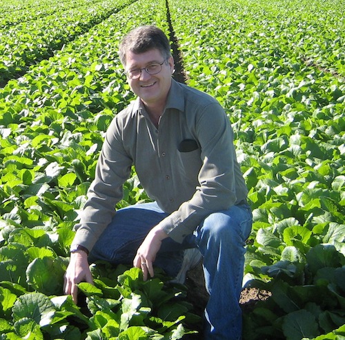
SEPTEMBER 19, 2022 – Speaker: Mike Prong
Topic: Fusion Landscaping “Low Water, Low Maintenance, Low Impact”
Mike will share ways this can be incorporated into any landscape and garden.
Mini Flower & Vegetable Show
OCTOBER 17, 2022 – Speaker: Pete Read
Topic: Backyard Birds
Pete is a retired teacher and long-time member of Nature London serving on their Board for many years including as President
and he kept the bird records for Middlesex County for over 30 years.
He leads bird watching hikes at Point Pelee and McGregor Park each Spring.
He is particularly interested in bird life, but will always stops to smell the roses.
January 16, 2023 – Meeting held via ZOOM – members will be sent a link via email
Speaker: Kerry Hackett
Topic: “Favourite Herbs and Homemade Remedies”
Kerry is a member of the National Institute of Medical Herbalists (UK), the Ontario Herbalist Assoc. (Past Pres.) and the Veterinary botanical Medicine Assoc. She is also a certified Master Gardener.
February 20, 2023 – Meeting held via ZOOM – CANCELLED
Speaker: Mark Rinker
Topic: “Arva Flour Mills”
Mark Rinker, along with his wife Jo-elle, are co-owners of the Arva Flour Mill. They purchased the Mill in October 2021. Both are born and bred Londoners and graduates of Western Univ.
March 20, 2023 – In Person Meeting at the Lambeth United Church
Speaker: Santiago Ramirez
Topic: Microgreens
Santiago will share how he and his family began the journey of growing their own nutrient packed greens that could be consumed by both young and old – in simple ways! They never use any pesticides, preservatives or harsh chemicals at any point during the growing process. Their Microgreens are Straight Up Tasty.
Design: “Memories of 2022” A Small Dried Arrangement.
April 17, 2023
Speaker: Norimi Sakamoto and John Jacobs of Shogun Maitake Canada Co.
Topic: Learn about the Maitake Mushrooms aka “Dancing Mushrooms” that grow in the mountains of north eastern Japan and now, they are also grown just down the road! Their health benefits are incredible!
Design: “By the Meadow” – A Water-viewing Design
September 18, 2023
Speaker: Cheryl Losch
Topic: “Myths and Legends in the Garden”
Cheryl is a horticulturalist, graduating from Univerity of Guelph and has been involved with Horticultural Societies for 19 years.
Design: “Late Summer Bounty” – an interpretive design
MINI FLOWER & VEGETABLE SHOW
October 16, 2023
Speaker: Dianne Wheler
Topic: “Preserving Your Harvest”
Dianne is a Master Gardener and will share some of the benefits of freezing and dehydrating her harvest and tips for preserving the harvest to enjoy throughout the seasons.
Design: “Autumn’s Harvest” – a design to include fruits and vegetables.
PLANT ADOPTION NIGHT – Bring a plant or 2 and adopt a plant or 2 (Perennials and Houseplants welcome).